In part one of this four-story series, we look at what the reduced snowpack means for the West Kootenay’s water supply.
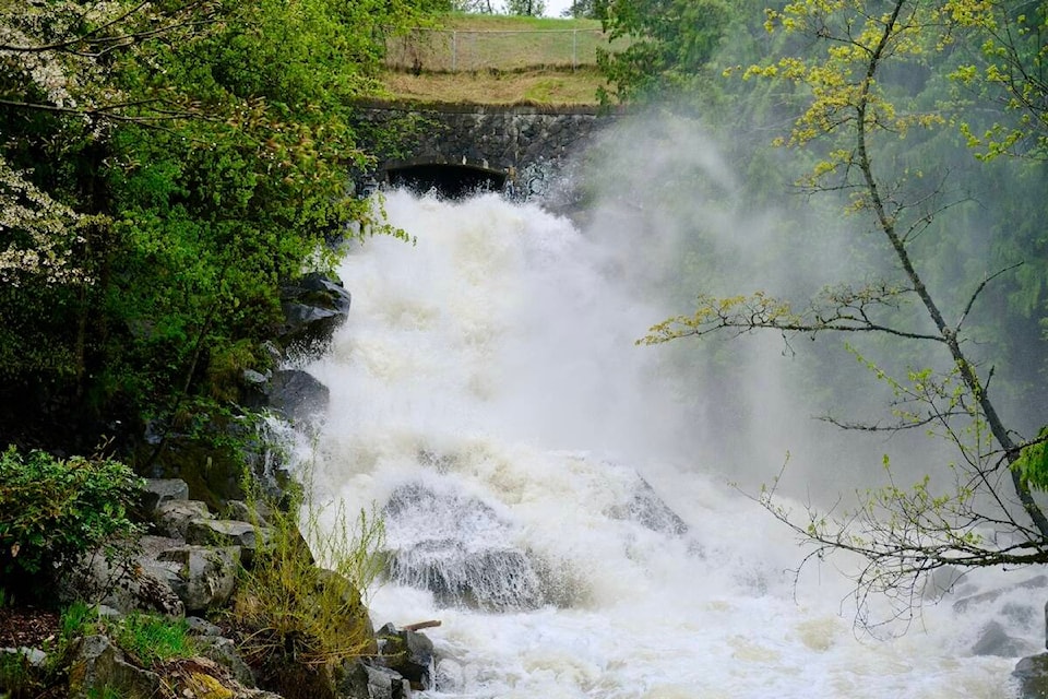
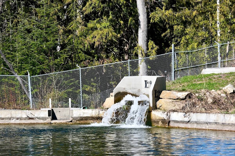
The reservoir at Mountain Station, which feeds all the water pipes in Nelson, is not really a reservoir.
If its three feeder creeks — Five Mile Creek, Selous Creek, and Anderson Creek — suddenly stopped flowing into it, it would be empty in 24-to-36 hours, says Chris Johnson, the city’s manager of community planning, climate and infrastructure.
“Our reservoir is actually the snowpack, along with Five Mile Creek and the other creeks,” he says. “We don’t have a reservoir like a larger city.”
He cites the example of Calgary’s Glenmore Reservoir, which is a lake created by a dam on the Elbow River.
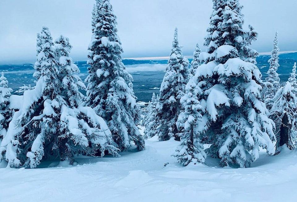
The West Kootenay snowpack is only at 72 per cent of normal this year as of both March 1 and April 1, according to the province’s Snow Survey and Water Supply Bulletin.
But a low snowpack is not necessarily a threat to Nelson’s water supply, says Johnson.
“We could still have a spring and summer such that enough precipitation falls that ensures the creeks continue to run strongly throughout the dry season.”
Should Nelson be worried about its drinking water supply over the long term, in light of the lower snowpacks caused by climate change? What about other places in the West Kootenay?
It depends on the interactions of a multitude of factors including snow, rain, temperature, the aspect (north or south facing) of the watershed and how much forest cover it has.
Across the province the snowpack on April 1 was 63 per cent of normal, the lowest average snow level since 1970. The provincial government’s River Forecast Centre, which measures snowpack, states that it is unlikely there will be much additional snowfall this year.
The low snow levels and the very light April precipitation across the province have “significantly elevated drought hazards for the upcoming spring and summer,” the bulletin states.
Water systems in the West Kootenay
There are hundreds of water systems in the West Kootenay, ranging from individual rural households drawing from a small creek, to larger centres like Nelson, Trail, Creston and Castlegar, all of which have differing geography and a variety of water sources.
There is great deal of variation in these systems’ vulnerability to a lowered snowpack, says Uli Wolf, general manager of environmental services at the Regional District of Central Kootenay.
If they get their water from a lake or river, like Balfour, Grandview, or Woodbury, Wolf says they will be less affected.
But systems dependent on surface water (from creeks) — like Nelson, Ymir, Kaslo, and South Slocan — are more vulnerable. This is especially true of the Arrow Creek system that supplies water to Creston and Erickson. That system has had severe water shortages in recent years and is the subject of a major RDCK feasibility study to find alternative water sources for both domestic use and irrigation.
For surface water users, Wolf says reliability of water supply depends on whether the precipitation comes as rain or snow, at what time of year, and over what span of time.
“For water supply, I would say that precipitation over the course of the warmer season is almost more important (than the level of the snowpack). We know that typically June, for us, is actually a fairly rainy month. It provides a fairly significant amount of water.”
‘A beautiful system’
Nelson hydrologist Martin Carver says the snowpack doesn’t just store water for people. It’s for forests, animals and groundwater — entire ecosystems.
“It’s a beautiful system that naturally stores water for the late summer in the fall when it’s needed,” he says, adding that the low snowpacks are “very worrying” because they are crucial part of a larger system: “a network of snow and glaciers, lakes and reservoirs, rivers and streams, wetlands and groundwater.”
Carver is the author of a 2017 report entitled Water Monitoring and Climate Change in the Upper Columbia Basin, in which he wrote that snowpacks in the Columbia Basin dropped by an average of 22 per cent between 1956 and 2005.
In it he explains that across the West Kootenay in recent years the snowpack has been shrinking due to climate change. It’s been melting and running off earlier, and more precipitation is coming down as rain instead of snow.
“When you see it coming as rain and running off, you’re not going to have as much for the summer.”
If precipitation comes as rain in the late winter or early spring, it can cause flooding and it does very little to replenish groundwater, which is one of the functions of a more gradual snowmelt.
Carver says that groundwater recharge is vital helping to sustain late season flows for many purposes including ecosystems and community water supplies.
He says winter precipitation is projected to increase modestly over the coming decades, but as warming reduces the proportion of precipitation falling as snow, a decline in snowpack is expected.
He predicts that eventually there will be no snow, just rain, in basin valley bottoms.
Watersheds and climate change
In Nelson, Johnson says the level of the snowpack alone does not determine whether the city will impose water restrictions.
His staff continually checks flow levels in the three source creeks, but there is no specific water level that would trigger a water restriction.
“If we had a really big reservoir, we could say, ‘We’re going to water up, we’re going go out and capture everything that we can right now.’”
But because the city doesn’t have that, “it’s a lot more reactive. We’re looking at the snowpack, we’re looking at the stream flows, at how the streams are reacting, at the rainfall, and from there gauging whether it time to put in restrictions.”
Carver says that in terms of snowpack and water, the City of Nelson is less threatened than it might seem, even though its only source is surface water.
“Its watersheds are fairly large — Five Mile Creek in particular is fairly large, and that’s helpful. And there’s a good proportion of north facing areas, which is a bonus. And there’s a fair degree of protection in the sense of the forest cover, which helps to moderate melt rates.”
He says water sources in the region that have any or all of those three things — large size, a north face, and good forest cover — are somewhat shielded from the effects of climate change.
But as the climate changes, he says, assumptions based on past ecosystem behaviour and water availability will need to be updated to reflect the impact of new climate patterns and conditions.
The activities of the forest industry, for example, affect the snowpack and runoff in various ways.
More snow accumulates on a clearcut, Carver says, “but then the snowpack experiences a different melt regime because of the lack of the protective forest cover to slow things down. Unfortunately, we are also experiencing higher temperatures — sometimes temperature extremes like high spring temperatures encouraging rapid melt — so we can get hit with a double whammy.”
Logging may not affect the drinking water supply of communities that get their water from a lake or river, but for surface water users, this can be complex and subject to change as new areas are logged.
Castlegar, Trail, and Kootenay Lake
For Castlegar and Trail, the story is different from that of Nelson because their water is sourced from large bodies of water.
Castlegar gets its drinking water from the Lower Arrow Lakes just above the Hugh Keenlyside Dam. Water is pumped from there into several reservoirs around the city and treated.
About 70 per cent of Trail’s drinking water comes from the Columbia River and the rest from a well at the Bear Creek aquifer.
For years the City of Nelson rejected the idea of Kootenay Lake as a drinking water source because of the expense of pumping it up the steep incline to the reservoir at Mountain Station, and because lake water would have to be treated more extensively (and expensively) than the water from clear mountain streams we now use.
“If we were to start pulling from the lake, the government requirements for treatment of the water would require filtration,” Johnson says. “Not only would it be a very large expense to build, but your ongoing operating costs go way up.”
Currently there is a small emergency intake on the lake near the mouth of Cottonwood Creek that is designed to treat lake water and distribute it to the lower parts of town — the flat parts to which it would not have to be pumped uphill.
But climate change, which is causing more frequent droughts and wildfires, is prompting the city to reconsider the lake as a water source for the whole city.
READ MORE:
• Kootenay Lake re-considered as drinking water source for Nelson
• West Kootenay’s low snowpack reflects grim provincial picture
• B.C.’s snowpack is 39% below normal levels
• Precipitation still at a deficit as B.C. nears 2024 wildfire season
• City installs pipes for emergency use of lake water
• New report outlines how to protect Nelson’s water sources
• Completion of Selous Creek line improves Nelson’s water supply