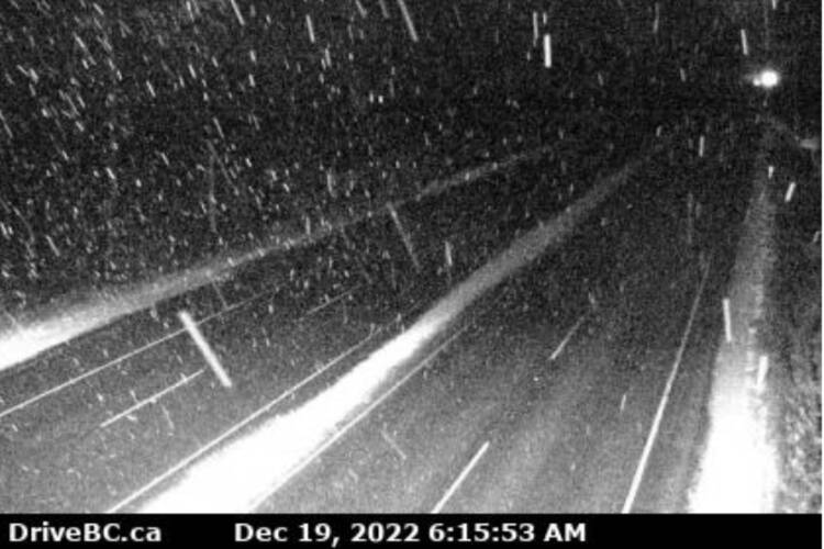
With an Arctic front chilling the air, Environment Canada issued a snowfall warning for most of Vancouver Island and the Lower Mainland early Monday (Dec. 19).
By mid-morning that was upgraded to a winter storm warning with heavy and blowing snow anticipated in Greater Victoria, leaving 20 cm or more of snow by Tuesday afternoon.
“Consider postponing non-essential travel until conditions improve. Surfaces such as highways, roads, walkways and parking lots may become difficult to navigate due to accumulating snow. Visibility will be suddenly reduced to near zero at times in heavy snow and blowing snow.”
The forecast warns of potential impact on rush hour traffic in urban areas. “If visibility is reduced while driving, turn on your lights and maintain a safe following distance.”
The snowfall warning prompted Sidney Volunteer Fire Department to tweet a reminder for residents. “Please take care while driving, dress in many layers and be safe. Salt your outdoor decks and stairs, wear appropriate shoes, and clear any snow off of your car before driving.”
BC Transit reminds riders to leave extra time as a handful of buses serving the West Shore detoured Monday morning due to the snow.
The 52 and 54 are both detouring on Metchosin as Lagoon Hill is not passable and the 54 and 55 routes are not servicing Duke. Routes 59 and 60 are detouring via Sooke, Happy Valley, and Latoria and not servicing Triangle Mountain
⚠️Winter storm alert⚠️
— Emcon Services Inc. - South Island Division (@EmconSouthVI) December 19, 2022
Forecast: Monday-Tuesday, snowfall accumulation of 10 to 20 cm. Expect Winter driving condtions. #VictoriaBC #Malahat #SookeBC #MillbayBC #ShawiniganLakeBC #DuncanBC #LakeCowichan #GulfIslands #BCStorm #yyjtraffic #ShiftIntoWinter pic.twitter.com/ypg0lKy8Fq
A low-pressure system is expected to land in Washington State late Monday evening and could brush through the southern part of British Columbia giving another round of snow. Due to outflow winds, heavier snow is expected for Victoria, Malahat Highway, Southern Gulf Islands, Lake Cowichan, Port Renfrew, and East Vancouver Island from Duncan to Fanny Bay. Snow will taper off late Tuesday morning on Vancouver Island and Tuesday afternoon on the mainland.
Snow is expected to be heavy at times Tuesday, with potential for blowing snow ending early in the afternoon then cloudy with a 40 per cent chance of flurries.
Tuesday’s forecast in Greater Victoria calls for 10 cm of snow with winds gusting to 40 km/h creating a wind chill of -10 C. Overnight will remain cloudy with flurries and -10 C.
Monday’s potentially dangerous road conditions were impacting everything from blue bin collection to getting to know your Member of Parliament.
The CRD said there could be delays and service disruptions for those expecting to have their recyclables picked up. Any blue bin materials not collected by 9 p.m. on Monday should be brought inside until the next collection day.
Cowichan–Malahat–Langford MP Alistair MacGregor cancelled his holiday open house in Langford which had been scheduled for Monday evening.
“MacGregor regrets not being able to connect with his Langford constituents, but, in light of Environment Canada warnings for up to 20 cm of snow and dangerous road conditions, tonight’s open house will be cancelled,” a statement from MacGregor’s office said.
The MP added he’d be keeping an eye on road conditions and decide later about tomorrow’s open house in Duncan.
A few reminders:
— Central Saanich (@CSaanich) December 19, 2022
❄️Residents are responsible for clearing snow from sidewalks bordering your property.
❄️Park vehicles off the street.
❄️ Shovel early and often to keep the load lighter for you.
👬 Lend a hand to someone who isn't able shovel their own sidewalk or driveway. pic.twitter.com/LCt7WAe9lI
READ ALSO: Snow settling down on Saanich Peninsula with more in the forecast for Greater Victoria
Do you have a story tip? Email: newsroom@oakbaynews.com.
Follow us on Twitter and Instagram, and like us on Facebook.