It’s Tsunami Preparedness Week April 9 to 15 and the Central Saanich Emergency Program is reminding residents of the risks on southern Vancouver Island.
While 90 per cent of residences, and all schools, in the district are safe from the threat of tsunami, coastal regions in the district and throughout Greater Victoria carry certain levels of risk.
The tsunami risk for the region generally comes from a Cascadia Subduction Zone earthquake off the Pacific coast of the Island, and feeling an earthquake in the region is considered an early warning for a potential tsunami.
However, the earthquake would have to be “substantial” in order to cause a tsunami.
The best way to learn what areas carry risk, and to plan potential escape routes, is to visit the Capital Regional District’s Tsunami Portal.
READ MORE: Greater Victoria tsunami risk mapped out in new online tool
The portal launched last fall and presents an interactive map outlining the level of risk in different areas of the region. The mapping features 30-metre resolution 3D models of land and undersea terrain across the entire region, and more detailed four-metre resolution models for higher-risk areas like Sidney, Sooke, and Port Renfrew.
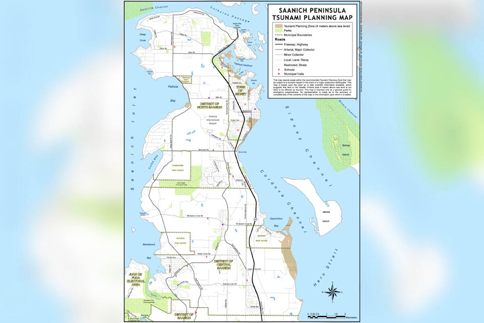
In Central Saanich, the main risk area is the low-lying lands around Island View Beach Regional Park.
In Sidney, the low-lying areas around Roberts Bay and Tulista Park are the main risk areas.
North Saanich risk areas are focused around Tsehum Harbour, Canoe Bay, Swartz Bay and Patricia Bay.
Throughout the Saanich Peninsula, areas immediately adjacent to the coast are at risk when they are four metres or less above sea level.
Central Saanich encourages residents to understand what tsunami zone they live in (Zone D), how to differentiate between the tsunami alert levels, knowing where high ground is and practise getting there on foot, plus signing up for the Saanich Peninsula Alert to ensure you receive notifications.
The alert system has four levels, as well as a cancellation.
Information statements are issued when there is a risk of minor waves at most and do not require any specific action.
Watch alerts indicate there is a risk, however the danger level is not yet known so the recommendation is to continue to monitor for updates and more information.
An advisory alert indicates strong currents are likely, and the coastal areas and shorelines should be avoided.
The highest alert is a warning indicating flood waves are possible and a full evacuation of risk areas is recommended.
A cancellation alert is the signal there is no longer a tsunami threat to the area of the alert.
Residents can sign up for Saanich Peninsula Alert online at saanichpeninsulaalert.connectrocket.com. Those looking for more information are encouraged to contact the Central Saanich Emergency Program at 250-544-4238.
READ MORE: Company creates shelter-in-place tsunami solutions as B.C. sits in risk zone
Do you have a story tip? Email: newsroom@peninsulanewsreview.com.
Follow us on Twitter and Instagram, and like us on Facebook.