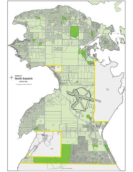
There are more than 40 kilometres of shoreline in the District of North Saanich and an additional 800-plus residences that have waterfront, or 16 per cent of all property in the municipality. And only a few people are watching where the water laps at the land, trying to keep an ever-changing landscape as up-to-date as possible.
It’s up to the small staff within the district’s digital information technology department to maintain current maps of the municipality and through that, up-to-date information on property boundaries, high tide marks, road and trail locations and even accurate addresses to ensure emergency services know where to go. This information is compiled in the district’s geographic information system (GIS), managed by Shawn Munro. He recently updated the municipality on recent efforts by his department and student Steven Hunter, to update the system.
It’s no small task and updating the district’s GIS began early last year with two projects: an inventory of the shoreline, and; improving the civic addressing within the municipality.
“This information is used by the public and by district staff to determine property information,” said Munro. “It’s a web-based system, allowing people to quickly find information. We always have to update it.”
Mother Nature does a lot of the updating in the meantime. Munro said determining property lines and existing shorelines is not easy — considering the ebb and flow of the ocean. His project compared the district’s legal property plans with existing GIS information and correcting any anomalies. Through the use of aerial photos, maps, zoning and agricultural land reserve information and official survey momuments, Munro said his department has created a current profile of the shoreline.
“It has had a lot of change over time,” he said.
Older maps and plans have been combined with newer information, he continued. While the B.C. Geological Survey identifies the legal shoreline, Munro said the district’s GIS identifies where the shoreline actually is today. He added a new legal survey will eventually need to be completed to recognize this reality.
Such change has ramifications for property owners, who might see the high tide line change over the years, affecting public beach access. While an official legal survey by the B.C. Geological Survey could be years away, if at all, Munro said, it will be up to individual property owners to re-survey their land if there are any questions on how their property lines have changed due to erosion or other natural factors.
The district’s own work was confined to natural boundaries, Munro said, as well as to older and more current maps and plans of the municipality. He said the south-east quadrant of Lochside Drive was most affected by the recent survey work, as plans from that area are 100 years old. He said as a result, there will be changes to the actual land survey of the shoreline there.
This information has a direct impact on land owners. They may be faced with a changed shoreline, one that no longer resembles older legal descriptions of their property. That change might be minuscule, or it could be more significant.
For the municipality, the GIS provides property-based details that helps with planning, infrastructure and financial information. It also shows ALR and zoning boundaries, which can effect development matters.
The collection of geographical information also helps ensure properties can be found in the case of an emergency. Hunter’s project in the GIS update was to improve local civic addresses, or create more point addresses.
For example, Hunter said different businesses at the airport — specifically at 9600 Canora Road — shared the single address. If people searched for a business name there, they might get only a single address on a map, meaning a physical search of the area (for signs, for instance) was necessary to find the place. The same was done at 23 Canoe Cove Road. Hunter said 17 distinct addresses were created there, each searchable by address or business name. The same goes for local First Nations communities.
“Not all buildings there were addressed specifically,” Hunter explained. “Now, they can be found by emergency services quicker.”
His work has led to unique addresses at those locations, searchable on the district’s web-based GIS. For organizations like the fire department, 9-1-1 dispatchers and even the post office, that means updated maps that can direct people to the right place the first time.